Search This Blog

Monday, June 20, 2022

That silo isn’t for cattle


The Text Content on Page 1 of Morning Herald, July 25, 1977 is:

That silo isn’t for cattle 

To the casual observer driving down Maryland Route 67 southwest of Boonsboro, the distant object lop of South Mountain looks like a farmer’s silo. Closer inspection would reveal that it is indeed a silo, but not the kind used to store cattle feed. This particular silo belongs to the US Navy and is one of at least three similar Top Secret Navy facilities in the Tri-State area. Two other silos are located atop mountain ridges in Pennsylvania and in West Virginia. Just what goes on inside the silos the Navy isn’t saying? 

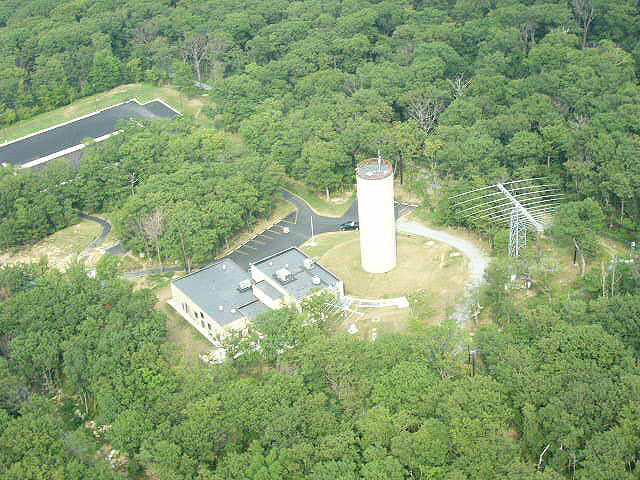
After repeated requests to the Navy for information on silos spokesman Ron Black gave this reply, “No information can be released its classified”.

According to residents of the area the Boonsboro silo was built sometime during the late 1960s. Like the others it is served by a narrow but a small road complete with guard rails. Although the Boonsboro silo is still in daily use the one located on Cross Mountain just inside the Pennsylvania state line north of Mercersburg was open earlier this year. The high chain link fence surrounding it has been ripped down and a heavy steel blast door leading into the silo was ajar recently. The silo is equipped with an elevator to each of its eight floors.  Although much of the equipment inside has obviously been removed, much remains... Heavy air conditioning equipment, air filters and electrical panels are still in place.  In an apparent effort to blast proof the equipment the panels are mounted on heavy springs with coiled wire lo take up movement. The silo apparently housed offices.   On the ceilings are fluorescent lamps.  The floors are tiled.

Whatever goes on inside the silos it is not related to the Alternate National Military Command Center near Blue Summit Pa.?  Sources at the Pentagon responsible for The Rock say they do not know anything about the Navy silos.

And until the Navy decides to talk its mysterious silos will remain one of the government secrets in the area plus

In reality these silo's were part of a microwave network that was the backbone of communications for the Presidential Emergency Facilities.

The White House Communications Agency (WHCA) would play a key role in the implementation of Continuity of Government (COG) plan. The Continuity of Government is the principle of establishing defined procedures that allow a government to continue its essential operations in case of nuclear war or other catastrophic events.  In 1954 a plan to implement emergency communications was developed and presented to the Secretary of Defense.  A major element of this plan was an emergency relocation strategy which provided for the dispersal of essential elements of the Federal Government.  This plan also addressed the necessary communications need by the President, and other Governmental agencies.  Because little or no reliable communications were available in the emergency relocation areas, the Army Signal Corps was tasked with the planning, designing, engineering, installing and maintaining the communications support of this program.

These sites were constructed very quietly and actually hidden from the Public but in reality were in plain sight and visible from miles around, several of these Continuity of Government sites were built in Maryland, Pennsylvania, Virginia, West Virginia, and Washington, D.C., these sites  were designed to house large numbers of federal officials in underground bunkers while the exposed concrete towers that housed sophisticated radio equipment kept communications open among the survivors, the military, and civilian populations.  These were among the first relocation facilities built in the 1950s and early 1960s as federal planners conceived of and realized a Federal Relocation Arc extending outwards from Washington were key documents and people could be sheltered during and after a nuclear exchange.

The Federal Relocation Arc included above- and below-ground sites located within a 300-mile radius of the nation’s capital. These sites were administered through the Executive branch’s White House Military Office (WHMO), while the communications personnel were attached to the White House Communications Agency (WHCA). The Presidential Emergency Facilities (PEF) were literally holes in the ground, deep enough to withstand a nuclear blast and outfitted with elaborate communications equipment, funds to support the sites wound their way through a circuitous route in the Defense Department.  All oversight for these facilities originated in the White House Military Office.

These sites in the Arc were the key to ensuring open lines of communications were built in a network that relied upon line-of-sight microwave technology, i.e., each transmitter and receiver had to have an unobstructed line-of-sight between its nearest neighbors for the network to be viable. These microwave hops were usually no more than fifty miles apart. “I’m assuming that when they did their studies they knew specifically where the main terminals were going to be and they looked for locations that they had line of sight, and they were all within forty miles of each other.”


Sunday, June 19, 2022

AT&T Facility Near Mercersburg PA. (1975)


AT&T Site on Hearthstone Mt. in MD.

The Text Content on Page 1 of The Hagerstown Morning Herald, July 25, 1977 is:
       
Arial view of AT&T on Hearthstone Mt. looking at the ridge line to Cross Mt. and Cannonball Tower
Hello, Hello

If there ever is a nuclear war restoring the nation’s telephone network might be one of the first orders of business.

That’s one of the reasons why American Telephone and Telegraph Co has buried a telephone switching station high atop Hearthstone Mountain four miles north of Clear Spring and just two miles from the Navy’s silo on Cross Mountain.

Although it’s not as secret as some government facilities around the area officials explain that the installation is designed to withstand the effects of a nearby nuclear blast.

The station which consists of 70000 square feet in a two and a half story underground building is made of concrete.

The delicate telephone gear inside is mounted on shock absorbers and the outside antennas about the only thing visible from a distance are en-cased in concrete pods

Access to the building is gained huge steel blast doors. Like other hardened sites the station has its own food and water supply. Filtering would remove nuclear particles from the air in the event of an attack.

The Hearthstone station is one of 65 around the world that provides routine telephone global com for the US military.

According to operations manager Bruce Parr the station normally handles only military traffic and in a busy hour it can relay thousands of telephone messages. But the equipment inside the station is standard telephone switching gear and Parr says it could be used to handle emergency or commercial traffic. Two other underground stations are also located in the area. One is at Monrovia in Frederick County and the other at Drainsville, VA near the Maryland, West Virginia and Virginia borders.

Parr says Hearthstone was picked as a site primarily because of its high elevation a, factor vital to reliable microwave communications. The 5.5 million dollar facility was built in the mid-1960s and is manned 24 hours a day by about 30 people according to Parr.

He says doesn’t pretend that nobody knows where or what the station is but he explains that the facility is not open to the public for “safety and for the protection of the personnel who work here”.

Article by PAUL BERTORELLI


Friday, June 17, 2022

Cowpunchers Demolition-revised


Round Top Summit, North Mountain
North Mountain's Round top summit site of Cowpuncher Tower
in the distance seen from Shanghai, WV..


Elevation
 1,673 ft. (509.9 m)
Location
Location
 Berkeley County, West VirginiaUSA
Range
 Ridge-and-Valley Appalachians
Topo map
 + 39.419821 N -78.08889 W

North Mountain is a mountain ridge within the Ridge-and-Valley Appalachians in the U.S. state of West Virginia.  The span consists of 20 miles (32 km) of ridge line and is noticeably higher in elevation, containing the mountains highest point of 1,673 feet (510 m) above sea-level at its Round Top summit near Arden in Berkeley County, West Virginia. North Mountain, as early settlers in the eighteenth century referred to the stream as to the "back" of the ridge when approaching it from the east. . North Mountain’s Roundtop Summit is also the site of a deactivated microwave relay station that was used during the Cold War

Tower History and Purpose             

Roundtop Summit, on North Mountain and west of Arden WV.  Its proximity to Washington, DC and other key locations made it a prime choice for a microwave relay station during the Cold War. In the late 1950’s/early 1960’s the Federal Government built a station here.

Cowpuncher Tower prior to Demolition

Cowpuncher Tower prior to Demolition
Construction of Cowpuncher tower was complete during the late 50’s early 60’s. Originally named Copper the cylindrical tower was renamed Cowpuncher in 1965.  Cowpuncher was exactly the same construction and served the same purpose as Cannonball.  The tower was part of a microwave network designed to provide communications to the President of the United States and emergency communications in the event of a nuclear attack. The Microwave route connected Camp David, Mt Weather, Site R and other key bodies of government directly to the White House.

Not only would the microwave network provide reliable communications, but the various sites also could serve as relocation facilities to withstand a nuclear attack. From these sites, the President could communicate with and address the American people.

Each facility had equipment to carry voice, video and secure voice and teletype. Of course, with our cellular networks today, such facilities are no longer necessary and even private citizens can communicate as long as the cellular towers still function.

There were seven facilities in the Presidential Emergency Network, each operated by the White House Communications Agency. Manned switchboards and communication centers were at each terminal. These communications centers became active in the event of a national emergency.

The sites were:

Site 1. Cactus Terminal, Camp David, Thurmont, MD
Site 2. Cannonball Relay, Mercersburg, PA
Site 3. Cowpuncher Relay, Martinsburg, WV
Site 4. Cartwheel Terminal, Washington, DC
Site 5. Crystal Terminal, Mount Weather, VA
Site 6. Cadre (or Creed) Terminal, aka Site R, Blue Ridge Summit, PA
Site 7. Corkscrew Relay, Boonsboro, MD
Final Destination. Crown, the White House, Washington, DC

The facility was deactivated in 1970  closed in 1977 and from that point was a popular place late at night with a particular group of people. The tower was demolished around 1983 surprisingly 
it was toppled in one piece.

The demolition of Cowpuncher tower as it fell 
Cowpuncher Tower in its “grave” (it was toppled and buried in place)
Google Earth view of Cowpuncher Tower near Martinsburg WV. Site has been demolished

Cross Section View of Tower